A little cooler today after a cold front pushed through the area last night. Afternoon temperatures only managed the lower 70s in Sweetwater to the middle 70s in Abilene today. Brownwood was still able to climb to near 80.
Tonight, clouds and moisture will be on the increase. Overnight lows will still make it into the middle 50s with winds mainly from the East at 5 to 10 miles per hour.
Tuesday through Thursday, moisture will be back in full force, and with a little upper level support, we could see a couple of very isolated showers or thunderstorms. Afternoon highs will climb from the upper 70s Tuesday to the middle 80s Wednesday and Thursday. Winds will be on the increase as well, becoming breezy Tuesday afternoon and fairly windy Wednesday and Thursday.
Thursday night into Friday another cold front will pass through scowering out most of the moisture for a few days. Skies will remain sunny Friday through Saturday with highs in the middle to upper 70s.
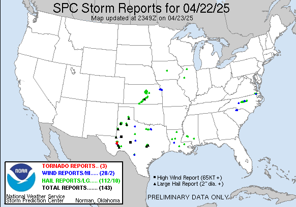
As I'm sure you are aware by now, severe weather was to blame for numerous fatalities and injuries across the country this w
 eekend. As the upper level system that brought us a few thunderstorms Friday night lifted into the Midwest Saturday and Sunday and met up with an environment ripe with moisture, unfortunately storms ravaged much of the Midwest. The graphic on the right is from the Storm Predicition Center and is a list of reported severe weather across the country for April 2. Click here to see the graphic on the Storm Predicition Center's website. Unfortunately, this is just the beginning of severe weather season across the country. Another system moving into the Central Plains and Midwest by Friday could bring the area another chance for severe weather.

No comments:
Post a Comment